Description
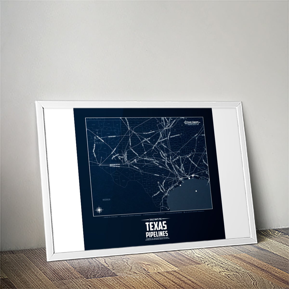
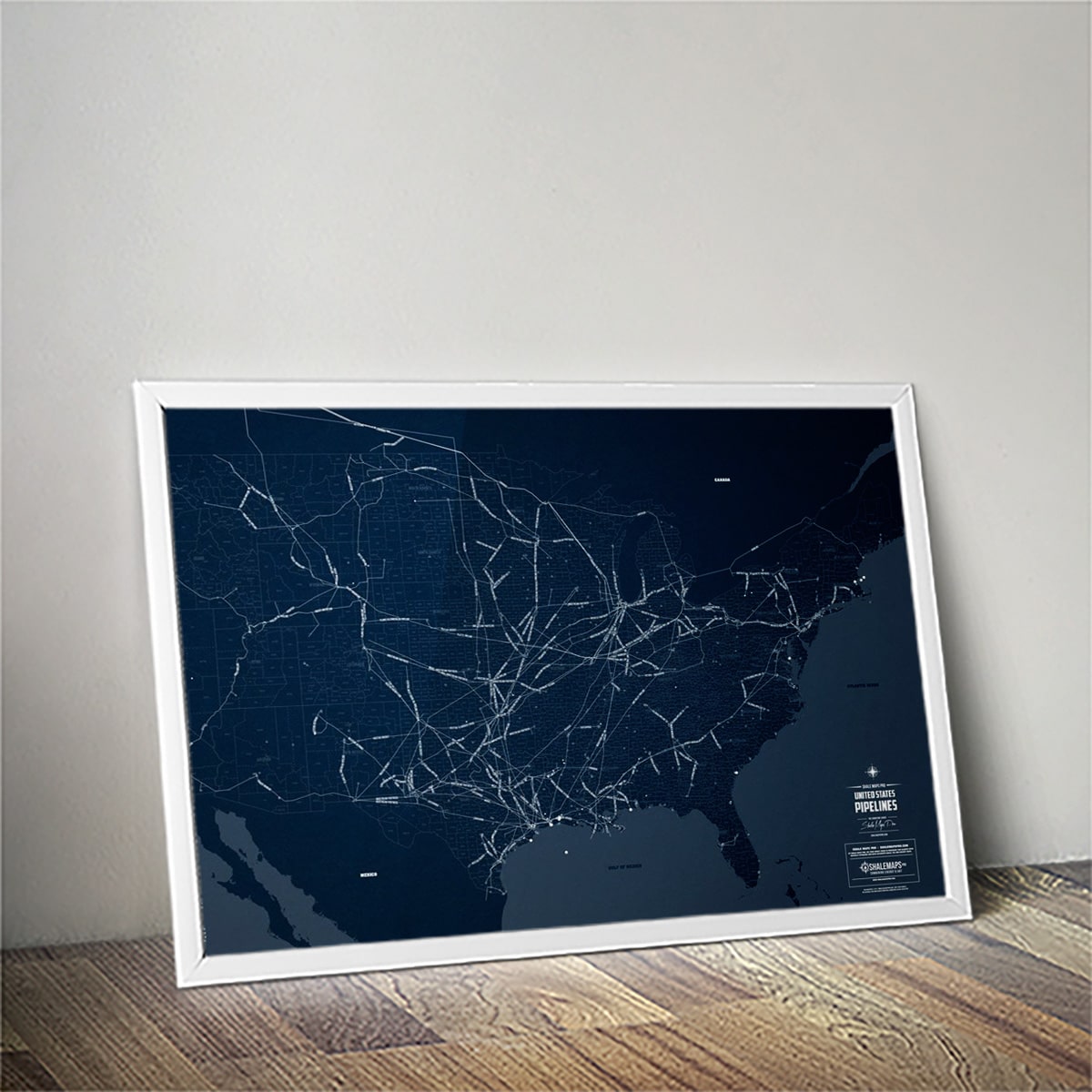
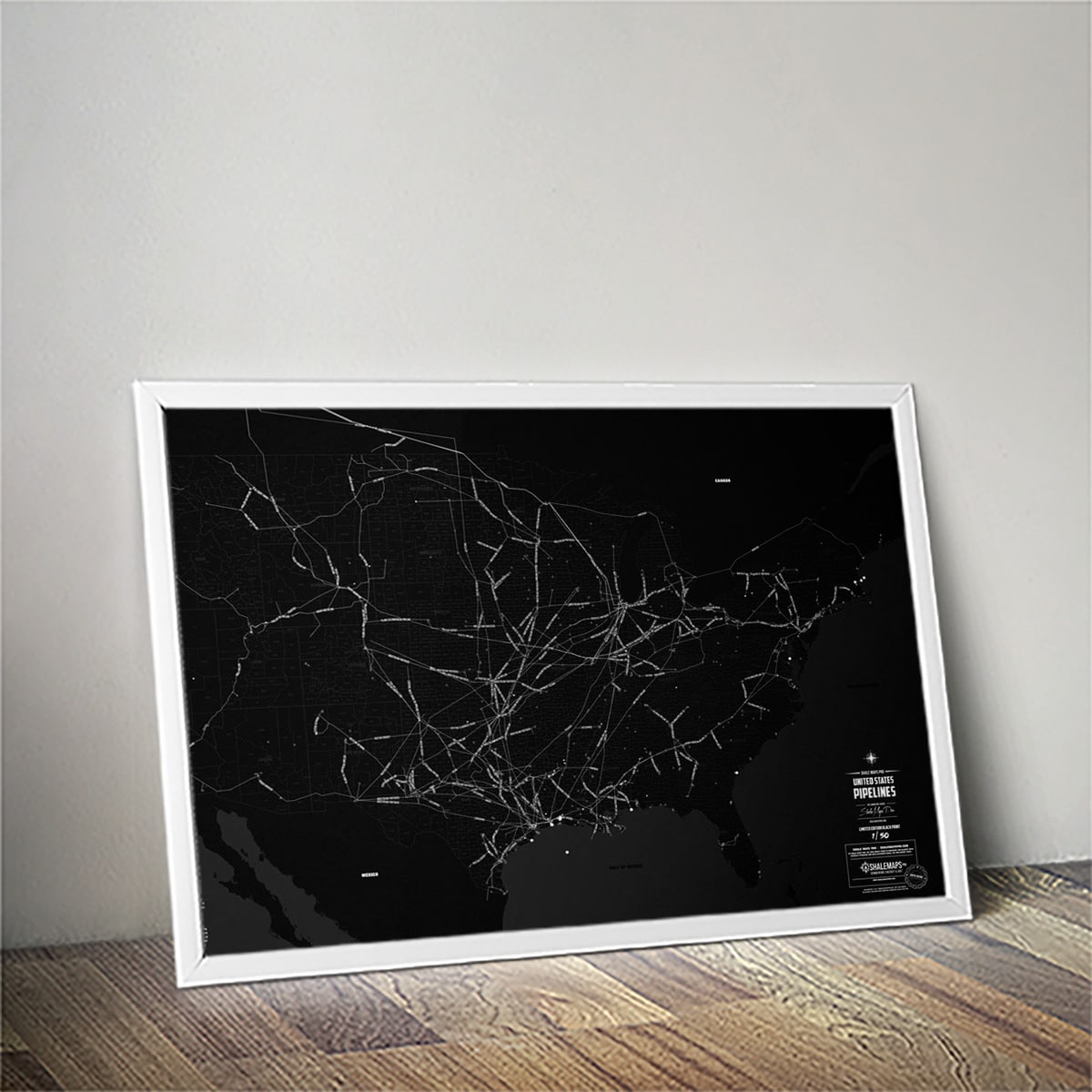
The United States Oil & Gas Pipelines Map | Limited Edition
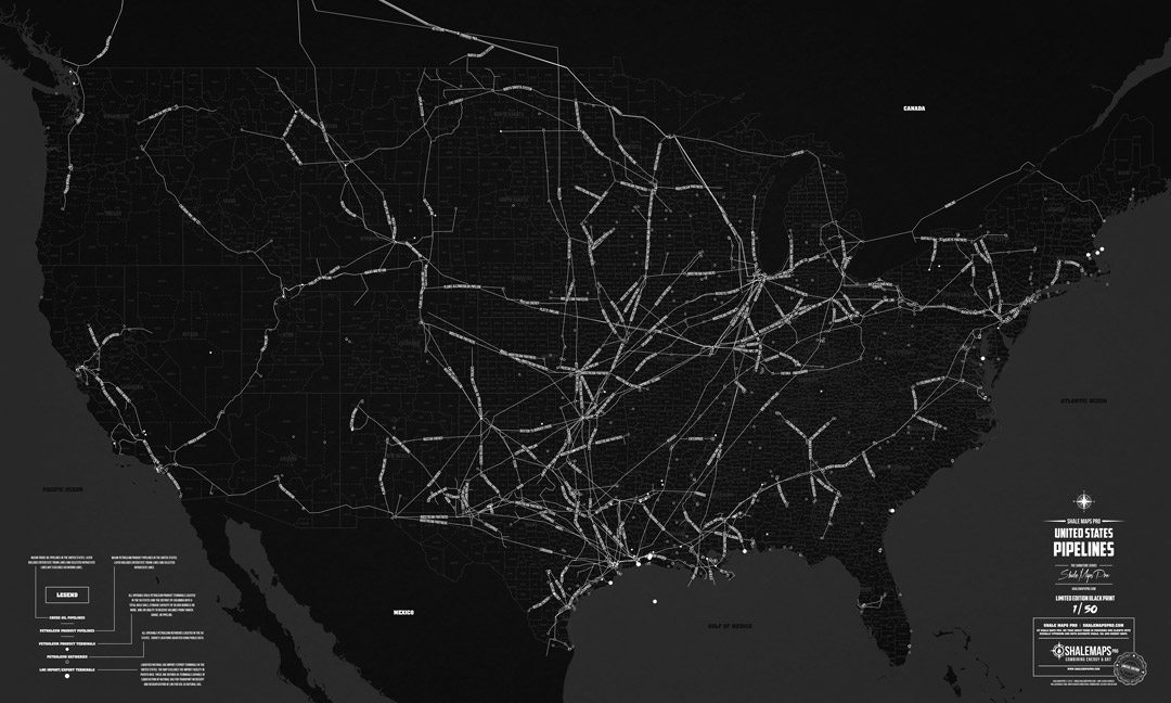
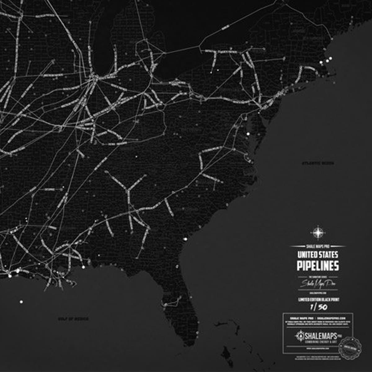
- Detailed United States Map labeled by State and County
- Crude Oil Pipelines labeled by Pipeline Name
- Petroleum Product Pipelines labeled by Operator
- Interstate Trunk Lines and Selected Intrastate Lines
- United States Operable Petroleum Refineries
- United States Petroleum Product Terminals
- LNG Import / Export Terminals
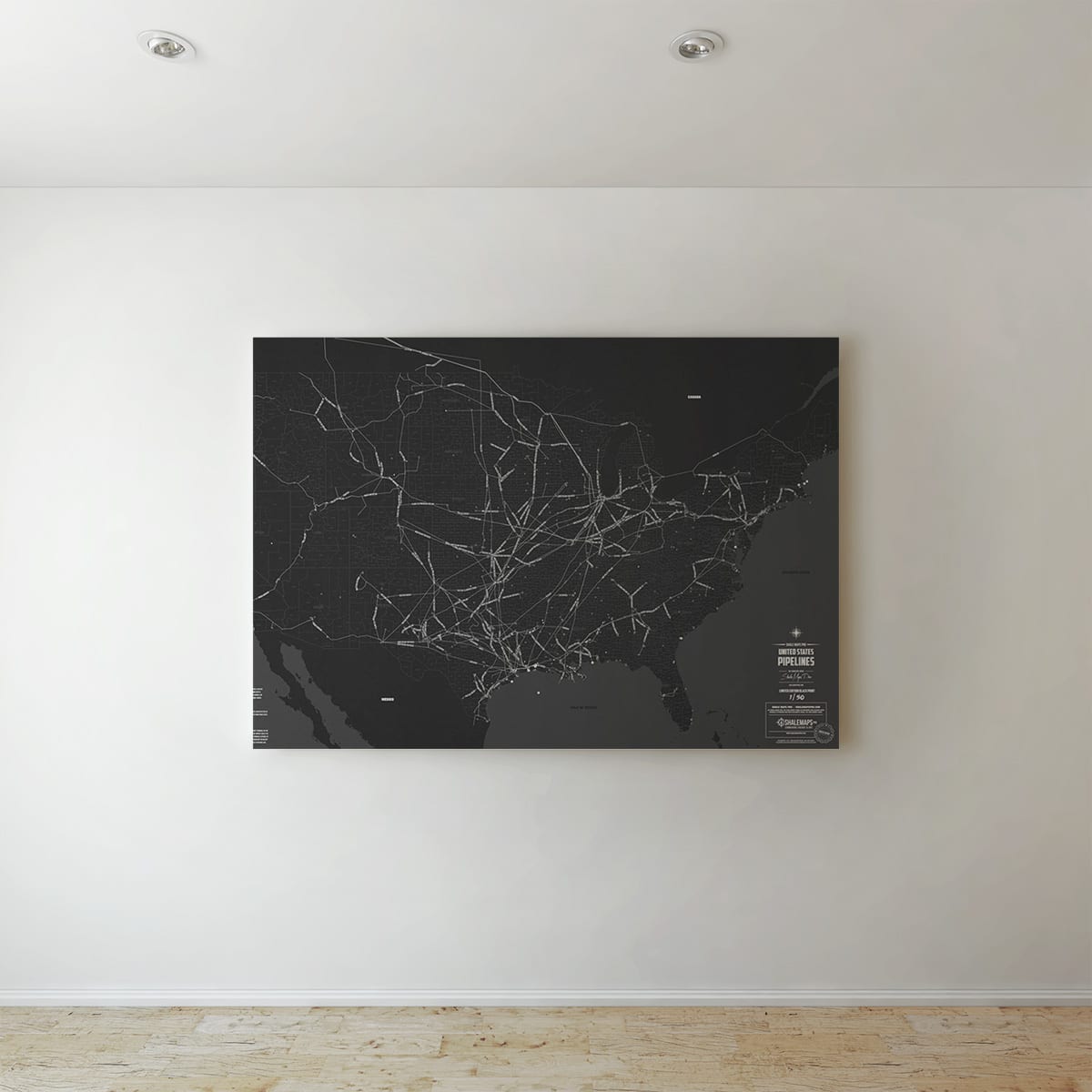
The United States Oil & Gas Pipelines Map | Limited Edition is now Available in Boxed or Rolled Canvas and Fine Art Paper!
The United States Oil & Gas Pipelines Map | Limited Edition Boxed Canvas:

- Printed on heavy-duty, poly-cotton blend canvas
- Fade-resistant matte-finish coating
- Hand-stretched & hand glued solid wood stretcher bars
- Ready to hang
- Packaged with care so it arrives in pristine condition
The United States Oil & Gas Pipelines Map | Limited Edition Rolled Canvas:

- Printed on heavy-duty, poly-cotton blend canvas
- Fade-resistant matte-finish coating
- Ready for Framing
- Packaged with care so it arrives in pristine condition
The United States Oil & Gas Pipelines Map | Limited Edition Paper Print:

- Printed on heavy-duty hi-quality fine art paper
- Images are generated from high-resolution digital scans and printed with archival quality inks. The giclee printing process provides better color accuracy than other means of reproduction.
Shale Maps Pro was created for the energy and art enthusiasts alike. Energy enthusiasts should have the opportunity to be able to see where all the oil shales were in the United State and at the same time make it pleasurable for the eye. We take tremendous pride in creating our products and we truly hope you enjoy our maps as much as do. They are great for any office or home. Please contact us with any questions at info@shalemapspro.com.